Geospatial
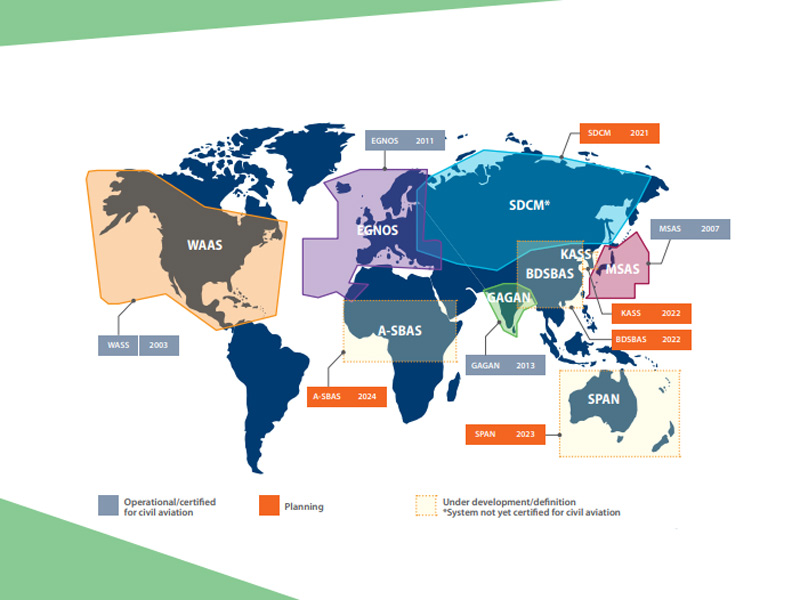
SBAS (Satellite-Based Augmentation System) consists of the space constellations, ground control stations, operation and maintenance stations and the users. Space part is mainly composed of geostationary orbit satellite constellation part, constellations realize enhancement signal effect by sending signals that is similar GNSS navigation information, these signals accepted by SBAS ground control station and decoding process, eliminate part of the navigation error, generate navigation enhance information and sent it the user, the user receives GNSS and SBAS signals at the same time, The error of regional navigation is eliminated by correction, obtaining the navigation and positioning service with higher accuracy.
Read more